-
Downloads
-
Windows
-
Navigation and maps
-
Cartograph Maps Desktop Edition
Cartograph Maps Desktop Edition
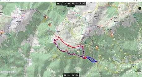
The Cartograph app views Mapsforge offline vector maps, offline raster maps, and online/WMS maps. It supports tracking, route search, overlays, hillshading, reliefs, track drawing, and has many other features.
### Features ###
- View Mapsforge offline vector maps (including v5 format).
- Full support for Mapsforge styling/render themes (including hillshading) and layers.
- Languages: Dutch, English, French, German, Italian, Russian, Spanish, Traditional Chinese.
- Offline raster maps: Locus SQLite maps, MBTiles, TwoWays/CompeGPS RMAP*, Oruxmaps SQLite*.
- Online map support (including WMS - Web Map Service maps), e.g. OpenStreetMap, OpenCycleMap, OpenSeaMap, WikiMedia hillshading, etc.
- Import online maps easily from files: "http://www.cartograph.eu/help_onlinemapimport".
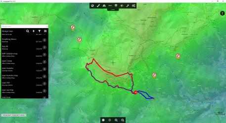
- Offline hillshading (from HGT elevation data).
- Offline relief shading.
- Offline slope map (e.g. for tour skiing).
- Contour lines (Mapsforge maps).
- Worldwide, free offline maps.
- Support for Mapsforge multi-maps (multiple .map files stitched into a single map).
- Night/day mode.
- GPS Track recording.
- Manual track drawing and editing.
- GPX import and export (basic KML import support).
- Upload tracks to Strava.com.
- Route altitude profile and elevation/slope visualization.
- Online route search.
- Live tracking and polling (using custom server, GPSies.com, or Cartograph server).
- Support for Mapsforge POIs, offline POI search, and dynamic POI loading.
- Scalable interface (e.g. to increase button sizes).
- Compass.
- Units: Celsius, Kelvin, Fahrenheit, metric, imperial, nautic.
- Decimal and degree coordinate modes.
- Voice/sound alerts along routes and waypoints. *EXPERIMENTAL*
- WaterSupply.at drinking water sources.
- Customizable user interface color (dark, light, and colors) and size.
* RMAP and Oruxmaps use various map projections and support is experimental. Please contact us if a map does not work so that we can add support for your projection.
Further information: http://www.cartograph.eu
Getting started: https://www.cartograph.eu/gettingstarted
Help&Tutorial: https://www.cartograph.eu/docs
Facebook: https://www.facebook.com/Cartograph.eu/
User manual: http://www.cartograph.eu/downloads/usermanual_en.pdf
YouTube how-to videos: https://www.youtube.com/watch?v=dn9EOg5h3yY&list=PLP8X6xYv-qCz46hplsfGLW1LNgywBZrTk
Drop us a line if you have questions, feature requests, or other comments: http://www.cartograph.eu/contact
### Maps ###
- OpenAndroMaps.org: very good maps for outdoor activities.
Cartograph Maps Desktop Editions 2020... The advantage that Cartograph Maps Desktop Edition presents us with over other competing programs is, without a doubt, its speed. Free Download and Install Cartograph Maps Desktop Editions...
How to play Cartograph Maps Desktop Edition:. Connect with Cartograph Maps Desktop Edition efficiently and transparently...
- Online map support (including WMS - Web Map Service Maps), eg OpenStreetMap, OpenCycleMap, OpenSeaMap, WikiMedia Shading, etc.
- Units: Celsius, Kelvin, Fahrenheit, Metric, Imperial, Nautical.
- Compass.
- Languages: Dutch, English, French, German, Italian, Russian, Spanish, Traditional Chinese.
- Online route search.
- Water supply in drinking water sources.
- GPS tracking recording.
- Free offline maps all over the world.
- Customizable UI color and size (dark, and light colors).